Exploring property records in Oakland County, MI, is recommended for individuals considering purchasing, selling, or evaluating land and tax obligations. County offices maintain deeds and recorded transfers, while local municipalities, including cities, villages, and townships, manage assessed values, zoning, and lot boundaries.
The county’s real estate environment can be described by homes valued near $308,600.00, typical monthly rents around $1,299.00, household incomes averaging $100,469.00, and annual property taxes approximately 1.33%.
How to Search for Property Records in Oakland County

In Oakland County, MI, property records are available online, in person, or by mail through the Oakland County Clerk/Register of Deeds Office and other county agencies. The primary online tools are the Super Index Search website and the Oakland Property Gateway.
For users who prefer not to navigate multiple portals, PropertyChecker offers a centralized search option that pulls relevant ownership and transaction details together.
Online searches are fast, convenient, and accessible from any location, while in-person visits provide staff support, public workstations, and immediate access to certified copies, though they require time and travel. Mail requests offer a practical alternative for those unable to visit, but processing typically takes longer.
Users often encounter challenges such as outdated legal descriptions, variations in name spelling, and differences in indexing. Using accurate identifiers, including Property Identification Numbers (PINs), legal descriptions, or exact owner names, improves accuracy and reduces the risk of missing or incorrect records.
 Property Ownership and Title Information
The Oakland County Clerk/Register of Deeds Office offers the Super Index Search website, which allows individuals to search for recorded documents such as deeds, liens, and mortgages. Users can search for the current property owner to learn who purchased a property and what was sold.
Staff in the Grantee/Grantor Unit of the Clerk/Register of Deeds Office actively assist by navigating the computer index and retrieving specific recorded documents by name. At the same time, the Tract Index Unit helps users trace the ownership history of specific parcels, subdivision lots, and condominium units.
 Property Sales and Transaction History
Users can access the County Clerk/Recorder’s Office Super Index Search website and enter an owner’s name, legal description, or property address to locate historical recorded documents. Scanned images of original deeds display sale prices (if recorded), parties involved, and recording dates.
While the County Clerk/Recorder’s Super Index Search provides direct access to scanned historical deeds, reviewing multiple documents can be time-consuming. PropertyChecker presents the same recorded sale and ownership data in a structured, text-based format that is easier to review and compare.
 Property Tax Assessment and Payment Records
In Oakland County, MI, local city or township assessors establish property assessed values. The Oakland County Equalization Division reviews these local assessments and adjusts them when necessary.
Residents may view their property assessment and up to seven years of tax history, including bills, payment status, and special assessments, on municipal websites or online portals. Additionally, the Oakland County Property Gateway provides free and fee-based access to land and property information, including tax parcel reports and maps.
If taxes remain unpaid after February 28, they are transferred to the County Treasurer’s Office for collection, with delinquent tax information available on the PayIt system or via the Tax Hotline. Property owners who disagree with an assessed value must contact the local assessor’s office or formally appeal to the local March Board of Review (BOR).
 Property Characteristics and Parcel Details
The Oakland Property Gateway is the official online portal for tax parcel reports, maps, historical aerial photos, and property characteristics. To perform an accurate parcel search, users must enter the 10-digit Parcel Identification Number (PIN) or the specific address.
The tool provides a detailed residential property profile, including descriptions, year built, square footage, and number of rooms. It delivers real-time tax data, assessed and taxable values, up to three years of tax history, plus GIS maps, plat maps, and property dimensions.
 Zoning, Land Use, and Planning Records
Local zoning ordinances, zoning maps, and master plans are managed by each city, village, or township within Oakland County. To obtain specifics on building height or size limits, permitted residential or commercial uses, and historic or environmental overlay districts, researchers should contact the municipality’s planning or community development department.
In contrast, the Oakland County Planning Division provides county-level land use maps, master plans, and zoning reviews.
 Legal Documents Affecting Property
Legal documents affecting property in Oakland County, such as deeds, mortgages, liens, and land contracts, are stored by the Clerk/Register of Deeds Office. The office’s Financing Unit handles documents that place liens or encumbrances on personal property that becomes part of real estate, including UCC filings, State of Michigan tax liens, and lien terminations.
 Building Permits, Inspections, and Construction Records
Individuals seeking building permit status or inspection information for commercial and multi-residential properties may use the Oakland County Accela Citizen Access portal.
Additionally, most municipalities in Oakland County manage building department records independently. Many cities provide access through their official websites or through shared platforms like the BS&A Online, which is used by the Royal Oak City Building Inspection Division.
 Maps and Visual Property Data
Located in Southeast Michigan, Oakland County spans approximately 867 square miles and manages a highly developed, high-density tax parcel system containing over 489,000 individual parcels.
The Clerk/Register of Deeds Office’s Tract Index Unit offers access to comprehensive visualization tools. These resources feature aerial imagery showing property boundaries, subdivisions, lot lines, and school districts, along with FEMA floodplain and elevation maps.
How to Use the Oakland County Parcel Viewer
The Oakland County Parcel Viewer is accessible through Property Gateway, a leading-edge online tool that provides free access to the county's land and property information, including tax parcel reports and maps. To launch it, visit the Oakland County website, navigate to Government, then Property Gateway, and click "Launch Property Gateway."
Once inside, search by entering a valid Oakland County Parcel Identification Number (PIN) or property address. A minimum of 5 characters must be entered. Partial searches are supported, for example, entering "1200 S" or a partial PIN like "1401100." Wild Card searches using the percent sign are also available.
Multiple PINs can be searched simultaneously by separating them with commas. Property Gateway is best viewed in Google Chrome at a minimum resolution of 1024x768.
Oakland County Property Statistics
Displayed here are charts summarizing the county's tax rates, accompanied by insights into median home values, income figures, and rent rates.

Median Rent
| Michigan |
$850.00
|
| National |
$840.25
|
-
+52.8 %vs Michigan
-
+54.6 %vs National

Median Home Value
| Michigan |
$147,900.00
|
| National |
$173,750.00
|
-
+108.7 %vs Michigan
-
+77.6 %vs National

Median Household Income
| Michigan |
$59,874.00
|
| National |
$65,108.00
|
-
+67.8 %vs Michigan
-
+54.3 %vs National
Median Property Tax Rate
| Michigan |
1.13%
|
| National |
0.74%
|
-
+17.7%vs Michigan
-
+79.7 %vs National

Unemployment Rate
| Michigan |
2.94%
|
| National |
2.87%
|
-
-1.0 %vs Michigan
-
+1.4 %vs National

Renter Occupied Housing
| Michigan |
14.56%
|
| National |
21.81%
|
-
+50.8 %vs Michigan
-
+0.7 %vs National
Oakland County Registrar of Deeds
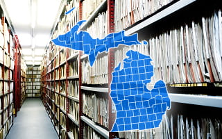
The Oakland County Clerk/Register of Deeds Office operates as a combined office responsible for the official recording and long-term protection of millions of property and land records. Recorded documents include deeds, mortgages, mortgage satisfactions, claims of lien, association discharges, certificates of trust, subdivision plats, condominium maps, and land contracts and assignments.
These records are actively used across the county government. For example, the Oakland County Equalization Division relies on recorded association discharges to verify that association liens affecting condominium units have been formally released before updating ownership data or finalizing assessment changes.
The majority of documents dating back to January 1, 1964, are searchable online through the Super Index Search website. Users may search and sort records free of charge by name, Property Identification Number (PIN), document type, or recording date. Fees are charged only for printing or downloading copies.
Records not available online, including older documents, may be accessed in person at the main office or requested through the mail. Plain copies cost $1 per page, while certified copies cost $5 per document.
Municipality-Level Property Records Information
Oakland County, MI, uses a sophisticated, decentralized, and highly digital framework to manage real estate property records. This system integrates a central county authority with 62 incorporated local communities, including 31 cities, 10 villages, and 21 townships.
While the Clerk/Register of Deeds Office serves as the official countywide repository for recorded property documents, individual municipalities retain primary responsibility for property assessment and, in some cases, operate specialized digital platforms providing access to property, tax, and land-use records.
Novi Township (no official website found)
- Addison Township
- Auburn Hills City
- Beverly Hills Village
- Bingham Farms Village
- Birmingham City
- Bloomfield Hills City
- Bloomfield Township
- Brandon Township
- Clarkston City
- Clawson City
- Commerce Township
- Farmington City
- Farmington Hills City
- Fenton City
- Ferndale City
- Franklin Village
- Groveland Township
- Hazel Park City
- Highland Township
- Holly Township
- Holly Village
- Huntington Woods City
- Independence Township
- Keego Harbor City
- Lake Angelus City
- Lake Orion Village
- Lathrup Village
- Leonard Village
- Lyon Township
- Madison Heights City
- Milford Township
- Milford Village
- Northville City
- Novi City
- Oak Park City
- Oakland Township
- Orchard Lake City
- Orion Township
- Ortonville Village
- Oxford Township
- Oxford Village
- Pleasant Ridge City
- Pontiac City
- Rochester City
- Rochester Hills City
- Rose Township
- Royal Oak City
- Royal Oak Township
- South Lyon City
- Southfield City
- Southfield Township
- Springfield Township
- Sylvan Lake City
- Troy City
- Walled Lake City
- Waterford Township
- West Bloomfield Township
- White Lake Township
- Wixom City
- Wolverine Lake Village
County Offices That Maintain Oakland County Property Records
The following section outlines the primary Oakland County offices responsible for maintaining and managing real estate records:

Oakland County Equalization Division
- 250 Elizabeth Lake Rd., Suite 1000 W, Pontiac, MI 48341
- (248) 858-0740
- equal@oakgov.com
Oakland County Clerk/Register of Deeds Office
- 1200 North Telegraph Rd., Building 12E, Pontiac, MI 48341
- (248) 858-0581 (Clerk); (248) 858-0606 (Register of Deeds)
- clerk@oakgov.com
Oakland County Treasurer’s Office
- 200 North Telegraph Road, Pontiac, MI 48341
- (248) 858-0611; (248) 858-0025 or (888) 600-3773 (Tax Hotline - Delinquent Taxes)
- treasurer@oakgov.com
- 614-221-8124
Oakland County Community Development Department - Planning Division
- 2100 Pontiac Lake Rd., Building 41 West, Waterford, MI 48328
- (248) 858-0720
- planning@franklincountyohio.gov
- The platform is designed to assist professionals and residents with detailed information related to property boundaries, land records, and geographic mapping. Survey Oakland issues weekly updates on land-related information, including Public Land Survey System (PLSS) areas and boundaries, section corner locations, and Land Corner Recordation Certificates (LCRCs).
Additionally, the Oakland County Department of Information Technology provides Survey Oakland, a specialized, subscription-based service that serves as a centralized source for land surveying and geographic data.
Other Counties in Michigan
- Alcona County
- Alger County
- Allegan County
- Alpena County
- Antrim County
- Arenac County
- Baraga County
- Barry County
- Bay County
- Benzie County
- Berrien County
- Branch County
- Calhoun County
- Cass County
- Charlevoix County
- Cheboygan County
- Chippewa County
- Clare County
- Clinton County
- Crawford County
- Delta County
- Dickinson County
- Eaton County
- Emmet County
- Genesee County
- Gladwin County
- Gogebic County
- Grand Traverse County
- Gratiot County
- Hillsdale County
- Houghton County
- Huron County
- Ingham County
- Ionia County
- Iosco County
- Iron County
- Isabella County
- Jackson County
- Kalamazoo County
- Kalkaska County
- Kent County
- Keweenaw County
- Lake County
- Lapeer County
- Leelanau County
- Lenawee County
- Livingston County
- Luce County
- Mackinac County
- Macomb County
- Manistee County
- Marquette County
- Mason County
- Mecosta County
- Menominee County
- Midland County
- Missaukee County
- Monroe County
- Montcalm County
- Montmorency County
- Muskegon County
- Newaygo County
- Oceana County
- Ogemaw County
- Ontonagon County
- Osceola County
- Oscoda County
- Otsego County
- Ottawa County
- Presque Isle County
- Roscommon County
- Saginaw County
- Sanilac County
- Schoolcraft County
- Shiawassee County
- St. Clair County
- St. Joseph County
- Tuscola County
- Van Buren County
- Washtenaw County
- Wayne County
- Wexford County